Our guides
Latin Quarter map: boundaries, metro stations and distances
A map in words of the Latin Quarter, Paris — where it starts and stops, the 5th arrondissement’s four quarters, the metro and RER stations, distances between landmarks. Checked October 2026.
What the Latin Quarter covers
The Latin Quarter is not an administrative division. It spreads over the left bank, in the 5th arrondissement and the north and east of the 6th, with the Sorbonne and the Montagne Sainte-Geneviève at its heart. The 5th itself has four administrative quarters — Saint-Victor, Jardin-des-Plantes, Val-de-Grâce and Sorbonne — and the place de la Contrescarpe, which we describe on its own page, is where they meet.
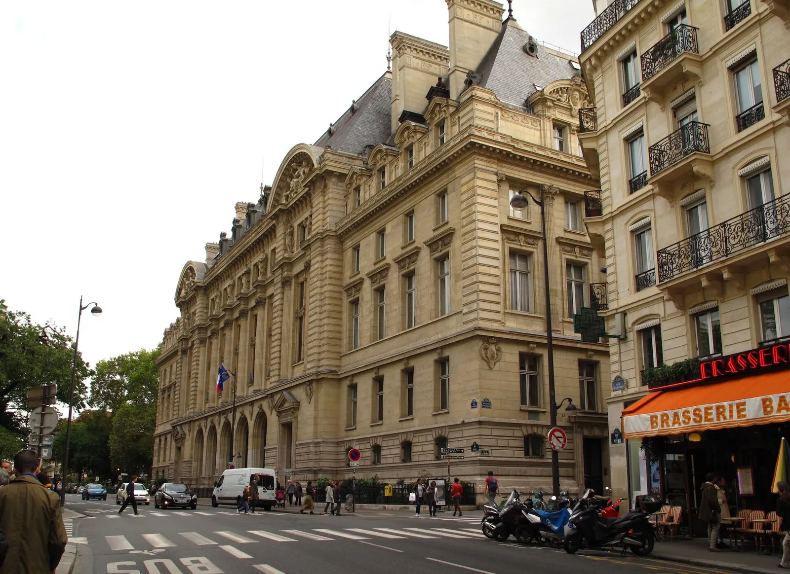
Photo: Rutger van der Maar, CC BY 2.0, via Wikimedia Commons

Its limits depend on the map. Wikipedia includes the fringe of the 6th around Odéon, Saint-André-des-Arts and the Luxembourg; other maps stop at the 5th. We follow Wikipedia, and say so.
The grid under the streets
The main axes still follow the Roman plan. Rue Saint-Jacques and boulevard Saint-Michel run along the north–south road of Lutetia, the cardo; boulevard Saint-Germain and rue des Écoles follow the east–west one, the decumanus. The Arènes de Lutèce are the amphitheatre of the same city.
Metro and RER stations
Seven metro stations serve the core, and the RER B and C stop at Saint-Michel: Saint-Michel – Notre-Dame (line 4, RER B and C), Cluny – La Sorbonne (line 10), Maubert – Mutualité (line 10), Cardinal Lemoine (line 10), Jussieu (lines 7 and 10), Place Monge (line 7) and Censier – Daubenton (line 7). On the edge are Odéon (lines 4 and 10), Cité (line 4), Gare d’Austerlitz (lines 5 and 10, RER C), and the RER B stops Luxembourg and Port-Royal.
Direct links from the district: line 4 or RER B from Saint-Michel – Notre-Dame to Gare du Nord; line 7 from Place Monge, Jussieu or Censier – Daubenton to Palais Royal – Musée du Louvre; RER C from Saint-Michel – Notre-Dame to Versailles Château Rive Gauche; RER B to Charles-de-Gaulle airport, or to Antony and then Orlyval for Orly.
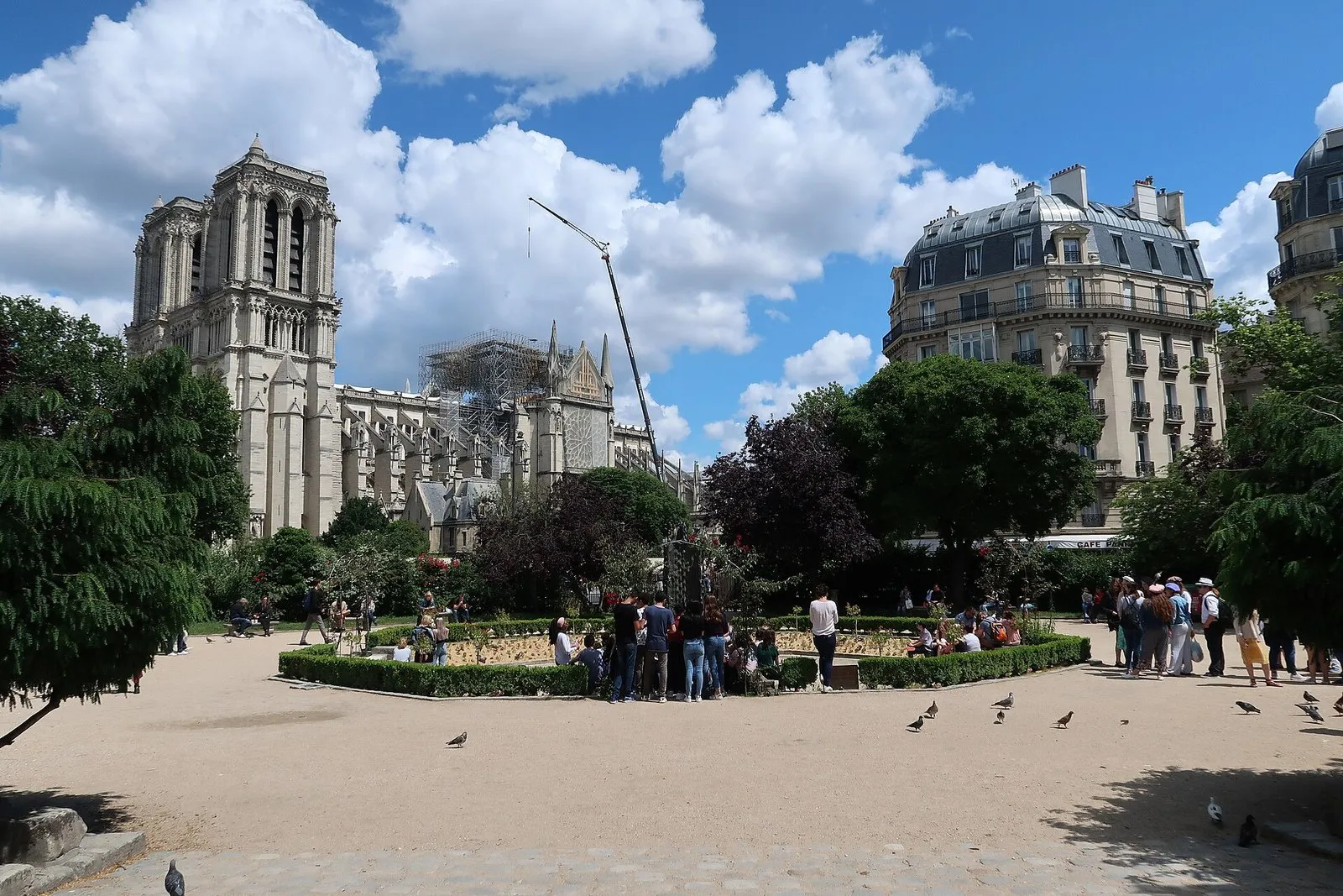
Photo: Celette, CC BY-SA 4.0, via Wikimedia Commons

One change affects the map this autumn: Saint-Michel station on line 4 is closed until 19 December 2026.
Distances between landmarks
These are straight-line distances between points in OpenStreetMap, measured on 4 October 2026. On foot, expect 20 to 40 per cent more.
- Parvis of Notre-Dame to the Panthéon: 800 m. Place Saint-Michel to the Panthéon: 810 m.
- Musée de Cluny to the Panthéon: 530 m.
- Panthéon to the place de la Contrescarpe: 320 m. Contrescarpe to the Arènes de Lutèce: 260 m. Contrescarpe to Saint-Médard, at the foot of rue Mouffetard: 500 m.
- Parvis of Notre-Dame to Shakespeare and Company: 120 m.
- Panthéon to the centre of the Luxembourg garden: 710 m; to the centre of the Jardin des Plantes: 1,030 m. These two are measured to the middle of the gardens, not to a gate.
- Place Saint-Michel to the place de la Contrescarpe: 1,080 m.
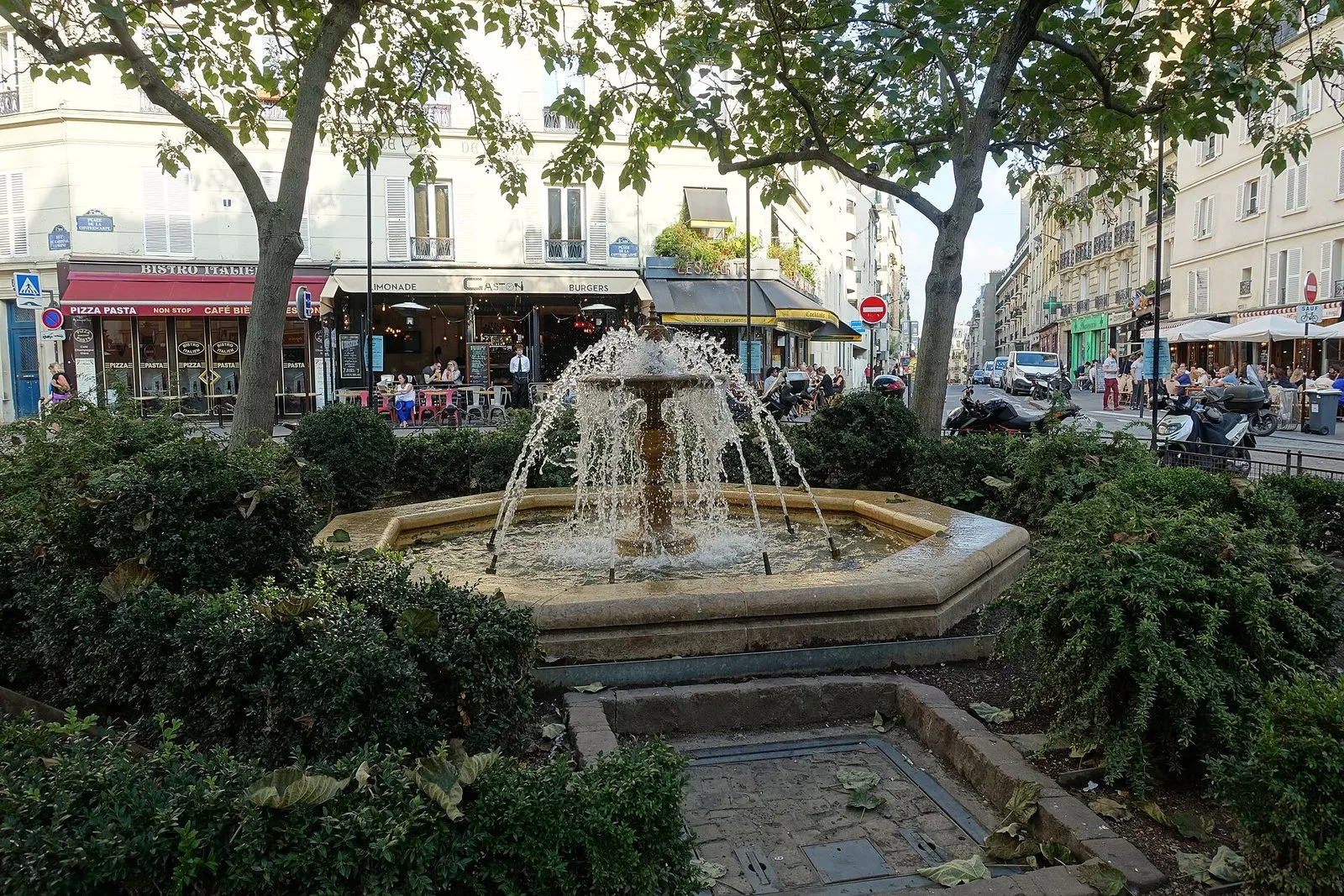
Photo: Guilhem Vellut, CC BY 2.0, via Wikimedia Commons

How we split the district for hotels
For our hotel pages we cut the district into six parts. Saint-Michel lies west of rue Saint-Jacques and the Petit-Pont, north of boulevard Saint-Germain: La Huchette, La Harpe, Saint-Séverin. Maubert – Notre-Dame runs east of rue Saint-Jacques as far as rue des Écoles. Sorbonne – Panthéon takes in the Sorbonne, rue Cujas, rue Soufflot and the Panthéon. Mouffetard covers the Contrescarpe, rue Mouffetard, rue Monge and the arena. Jardin des Plantes includes the garden, Austerlitz and the Gobelins side of the 5th. Odéon – Luxembourg is the fringe of the 6th. This is our own working division, not an official one.
Eight hotel pages cover these six parts: Saint-Michel, Notre-Dame, the Sorbonne and the Panthéon, rue Mouffetard, the Jardin des Plantes, Odéon and the Luxembourg gardens.
The 5th arrondissement in figures
The 5th covers 2.54 square kilometres and had 55,252 inhabitants in 2023, a density of about 21,753 per square kilometre, according to Wikipedia. It is served by metro lines 4, 5, 7 and 10 and by the RER B and C, and it holds the Muséum national d’histoire naturelle, the Cluny Museum and the Institut du monde arabe, as well as the Sorbonne, the Collège de France and the École normale supérieure. For a district this dense, the useful scale is the walking minute, which the next sections give.
Three walks, measured
Each leg below is a straight line between the coordinates of our guide data, with the walking time by our method, which multiplies the distance by 1.3 and walks at 80 metres a minute. The coordinates come from address geocoding, so a figure can differ by a few tens of metres from the OpenStreetMap points used above.
- From the river to the hill. Notre-Dame to Shakespeare and Company, 139 metres; to Saint-Séverin, 172 metres; to the Cluny Museum, 197 metres; to the Sorbonne, 125 metres; to the Panthéon, 425 metres. In all, about 1,060 metres, or 17 minutes without stops.
- Around the Contrescarpe. Panthéon to Saint-Étienne-du-Mont, 155 metres; to the place de la Contrescarpe, 302 metres; to rue Mouffetard, 113 metres; to the Arènes de Lutèce, 282 metres; to the Jardin des Plantes, 559 metres. In all, about 1,410 metres, or 23 minutes.
- The garden side. Institut du monde arabe to the Grand Mosque, 788 metres; to the Natural History Museum, 106 metres; to the Jardin des Plantes, 308 metres; to the Ménagerie, 179 metres. In all, about 1,380 metres, or 22 minutes.
The two long jumps
Two distances in the district are long enough to make people take the metro. The Jardin des Plantes is about 1,285 metres from Notre-Dame, or 21 minutes on foot, and about 1,680 metres from the Luxembourg Gardens, or 27 minutes. Between the Panthéon and the Luxembourg Gardens the distance falls to 631 metres, or 10 minutes, and between Notre-Dame and the Panthéon it is about 820 metres, or 13 minutes. In other words the district is compact in its northern half, around the Sorbonne, and stretches towards the south-east.
Which station for which end
Judged from the stations above, the western end belongs to Saint-Michel – Notre-Dame (RER B and C only, since line 4 is closed there until 19 December 2026), Cluny – La Sorbonne and Odéon, the centre to Maubert – Mutualité and Cardinal Lemoine, and the south-east to Jussieu, Place Monge, Censier – Daubenton and Gare d’Austerlitz. The RER B stop at Luxembourg serves the western edge of the 5th, near the garden. Place Monge and Cardinal Lemoine are the two entry points for the Mouffetard side, one on line 7 and one on line 10.
Sleeping on the map
Each of the eight hotel lists linked above is built around one of these landmarks, so the walk times in this page apply to them: the list of hotels near the Panthéon ranks the hotels around the monument, and the 5th arrondissement list covers the whole of the official district.
Landmark guides
On the map, the main guides are the rue de la Huchette and Saint-Séverin near the river, the Sorbonne and Saint-Étienne-du-Mont around the Panthéon, the place de la Contrescarpe and the Arènes de Lutèce on the Mouffetard side, and the Natural History Museum and the Ménagerie at the Jardin des Plantes. The overview is in our Latin Quarter guide.
History and distinctive features
- The four administrative quarters of the 5th cover Saint-Victor 60.4 ha, Jardin-des-Plantes 79.8 ha, Val-de-Grâce 70.4 ha and Sorbonne 43.3 ha, about 254 ha for the arrondissement. Source : fr.wikipedia.org
- The place de la Contrescarpe lies at the meeting point of those four quarters. Source : fr.wikipedia.org
- The main axes follow the ancient plan — rue Saint-Jacques and boulevard Saint-Michel run along the north–south cardo of Lutetia, boulevard Saint-Germain and rue des Écoles along the east–west decumanus. Source : fr.wikipedia.org
Hotels near the Latin Quarter
Some links are affiliate links: if you book through them, we may earn a commission, at no extra cost to you. How we are paid
Other hotels
Frequently asked questions
Where are the limits of the Latin Quarter?
There are no official ones. The district covers the left bank in the 5th arrondissement and the north and east of the 6th, with the Sorbonne and the Montagne Sainte-Geneviève at its heart; maps differ on the fringe of the 6th.
Is the Latin Quarter in the 5th or the 6th arrondissement?
Mostly in the 5th; the fringe around Odéon, Saint-André-des-Arts and the Luxembourg belongs to the 6th, according to Wikipedia, although maps do not agree.
Which metro lines serve the Latin Quarter?
Lines 4, 7 and 10 at the stations listed above, plus line 5 at Gare d’Austerlitz, the RER B and C at Saint-Michel – Notre-Dame, and Luxembourg and Port-Royal on the RER B.
How far is the Panthéon from Notre-Dame?
About 800 metres as the crow flies from the parvis of Notre-Dame; on foot, add 20 to 40 per cent.
How do I reach the airports from the Latin Quarter?
The RER B runs from Saint-Michel – Notre-Dame to Charles-de-Gaulle airport. For Orly, take the RER B to Antony and Orlyval; line 14 also serves Orly.
Is line 4 running at Saint-Michel in 2026?
No. Saint-Michel station on line 4 is closed from 14 September to 19 December 2026, according to the City of Paris. The RER B and C at Saint-Michel – Notre-Dame, and Cluny – La Sorbonne on line 10, remain open. We have not checked possible summer works on the RER B or C.
How big is the 5th arrondissement?
2.54 square kilometres, with 55,252 inhabitants in 2023, according to Wikipedia. That is a density of about 21,753 people per square kilometre.
How long does it take to walk across the Latin Quarter?
From Notre-Dame to the Jardin des Plantes it is about 1,285 metres in a straight line, which is 21 minutes by our method. From the Panthéon to the Luxembourg Gardens it is 10 minutes.
What institutions are in the 5th arrondissement?
According to Wikipedia, the Muséum national d’histoire naturelle, the Cluny Museum and the Institut du monde arabe, as well as the Sorbonne, the Collège de France and the École normale supérieure.
Which metro lines cross the 5th arrondissement?
Lines 4, 5, 7 and 10, plus the RER B and C, according to Wikipedia.